|
|
|
|
From Bradford-on-Avon the canal runs along the south side of the Avon valley to Avoncliff where it crosses to the north side of valley. Halfway to Avoncliff there is a swingbridge, used by lorries. This is normally left open as there is a normal-height footbridge for the lorry drivers to cross over to open the swingbridge. The towpath is moorable with a gangplank all the way from Bradford-on-Avon Lower Wharf to this swingbridge. After the swingbridge, there are some proper moorings with rings, then there is a small community of people trying to keep some ancient boats afloat. This leads up to the winding hole. After the winding hole, the towpath has a proper stone edge and is moorable with stakes all the way to Avoncliff. Avoncliff Aqueduct from Cross Guns pub garden. 17-01-2019
AvoncliffAs you approach Avoncliff, there is a section of moorings for permit holders only, then a small section of 48 hour moorings leading up to the water point. The last space can use the stubby bollards provided, but the other spaces need stakes. We have always found space here, and it is a short walk to the Cross Guns pub which has extensive terracing overlooking the Avon and the Avoncliff Aqueduct. There are no shops in Avoncliff but remarkably it still has a railway station even though only 50 people live there. There are local trains to Bath and Bristol, but there is a much better service from Bradford-on-Avon. If you do need a shop, you can walk up the steep hill and across the crossroads: it is then a gentle walk to Lower Westwood. When you meet the main road, walk left for the New Inn and a National Trust stately home. Walk right then turn 3rd right for the local convenience store. There is a footpath to take you back to the canal: turn left out of the shop, go round in a semi-circle then right and walk across the green; at the nursery turn right, then left then go through a metal stile to access the footpath. Avoncliff water point and moorings. 27-03-2019
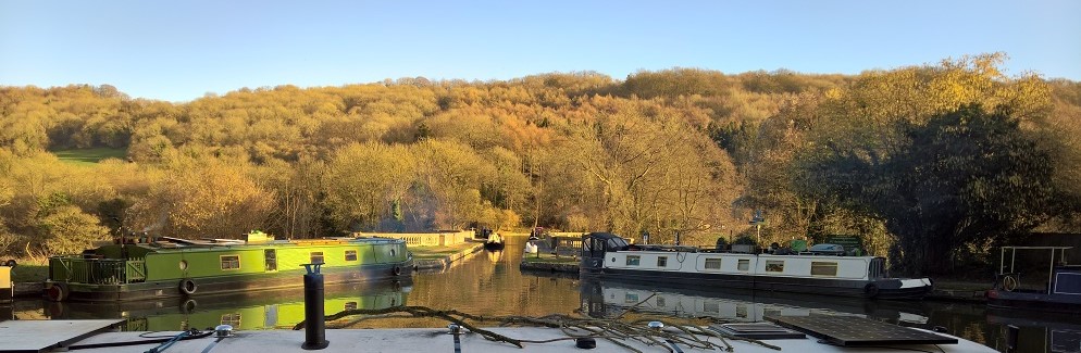
Back on the canal, there is a sharp 90 degree bend before the aqueduct. On the far side, the aqueduct has an extension built by Brunel when the railway tunnelled under the canal, but it goes off at a slight angle so beware. Immediately after the aqueduct there is a sharp bend to the left, and then the canal narrows significantly at the site of a former swingbridge. After the swingbridge site, there are extensive 48-hour moorings with further moorings after that. However, an underwater ledge protrudes along the whole length of these moorings. Depending on the water level, which may vary a few inches, you will either need to use a gangplank or you may end up aground on the ledge if water levels drop. Limpley StokeThe underwater ledge continues almost as far as Limpley Stoke, but stops before you get to bridge 175. The towpath is moorable with stakes as you approach the bridge, which is a good place to stop to explore Limpley Stoke and Freshford. There is a no moorings section after the bridge, but then the towpath is moorable again with views across the valley. From bridge 175 you can walk down the hill, across the river and under the railway bridge then turn left to walk into Limpley Stoke. The pretty GWR station is now a private home, passenger services having stopped in 1966. After walking past the station you come to the Hop Pole pub. Unfortunately, this was closed for refurbishment while we were there. However, the entrance to the Limpley Stoke hotel is opposite, which has a large bar open to non-residents and an attractive terrace with views up and down the valley. If you continue walking along the main road, you will eventually come to the attractive village of Freshford with its popular pub near to the River Frome. View downstream from Dundas Aqueduct. 24-03-2019
Dundas Aqueduct and WharfAs you continue towards Dundas, there are sunny moorings as you approach a winding hole. The canal then goes through an S-bend before reaching Dundas Aqueduct with a right-angled bend to the left. There are moorings on both sides of the canal before you reach the aqueduct itself and a few further moorings on the far side. The pump-out and water point are straight ahead on the far bank. It is a short walk up from the wharf to the main A36, where there is a petrol station selling alcohol and basic groceries. A lane leads up over the hill to Monkton Combe where there is a cosy, stone-built pub. Just past the petrol station is a road sign showing the start of Limpley Stoke. Don't be tempted by this, the village is quite a distance and the B-road leading down from the traffic lights is winding with no footpath and very fast traffic. From the wharf, the remains of the narrow Somersetshire Coal Canal extend away to the left, before terminating at the A36. The canal was built to bring coal down from the Somerset coal field but was derelict by the end of the 19th century. It was bought by the GWR and converted to a railway. Traffic was mainly coal, but a passenger service operated from 1910-1915 and 1923-1925. Monkton Combe Halt was used in the filming of The Titfield Thunderbolt in 1952, after the line closed in 1951. The Kennet and Avon Canal itself continues westward from the wharf, under a lattice footbridge. There are extensive moorings on the towpath side. |
Click on any picture to see a larger image.
|